[5] Indrani Pitha:
The Mandala Map (yantrakara khwopa dya: )
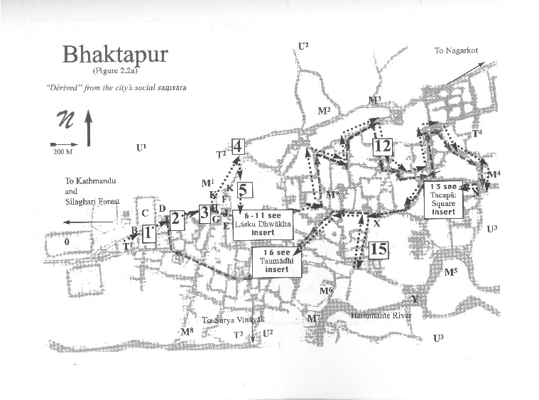
 Continue walking back up toward Khauma Square. The building at the bottom of the stairs is the Indrani Pitha [M1], an open shrine to one of Bhaktapurąs Piga(n)dya: ," these are the group of nine mother goddesses living in the open-air shrines that surround the city in a mandala pattern [M1M9] .
Take a seat at one of the nearby satas. If you wait for a moment, you will see people casually walking down the street touching the idol, ringing its bell, touching their head to it, and sprinkling on prasad . Such practices emplot the place onto a larger structure of Bhaktapurąs "sacred space."
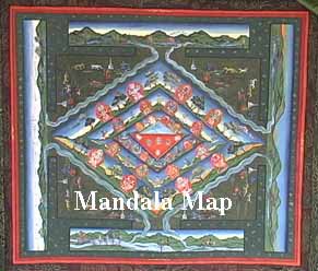
In the Mandala Map of Bhaktapur, the outer ring shows the Piga(n) dya:. This is a pervasive South Asian representation of a boundary and its contained area within which ritual power and order is held and concentrated. This ring of Piga(n) dya:s creates a circumference that separates different worlds‹ the inside (pine) order and the outside (dune) disorder, and operates as a membrane that filters the flows into the city.